New Wilderness Voices: November 7 reading at RiverRun Books

On that morning after the ice storm, I left my chilly powerless house to warm up in the forests of Mount Agamenticus.  My goal: to hunt down a tiny aphid-like insect, the woolly adelgid, that kills hemlock trees.

I had volunteered to monitor a patch of forest below the mountain, a project organized by the Maine Forest Service to stop the spread of this invasive pest, which, if left unchecked, kills hemlock trees. In the forests of North Carolina, Virginia and other states, large stands of hemlock have died off, their evergreen foliage replaced with grey brittle needles.

I went to the woods that December morning because I love hemlocks, the way their lacy branches spread out and make the woods into a cathedral. In the winter, I love seeing the patches of packed down snow beneath a hemlock’s sheltering branches–evidence that deer are keeping themselves cozy and warm.

After a couple of years spent hunting for the woolly adelgid, I learned about the Waterman Fund Alpine Essay contest. The theme for that year (2010) centered on stewardship and the wild, and I wrote an essay about the hemlock trees, “Hunting the Woolly Adelgid.” Much to my surprise and delight, I won the contest, including a $1500 prize and publication in Appalachia, the biannual journal of the Appalachian Mountain Club.

Now, that essay, along with those of other contest winners, has been published in New Wilderness Voices: Collected Essays from the Waterman Fund Contest, edited by Christine Woodside and Amy Seidl (University Press of New England, 2017).

This week, on Tuesday, November 7, at 6:30 p.m. at RiverRun Books in Portsmouth, NH, I will be reading from the book,  along with writer Bethany Taylor and editor Christine Woodside. We will also discuss this year’s Waterman Fund Contest, with its February 2018 deadline. I suspect we may also hear a bit about Christine’s 2013 book, Libertarians on the Prairie: Laura Ingalls Wilder, Rose Wilder Lane, and the Making of the Little House Books, which recently came out in paperback.

The woolly adelgid develops over the winter months in tiny white ‘woolly’ cocoons attached to the bottom of hemlock foliage. The aphid, originally from Asia, has been spreading north from the southern US. A few years ago, a shipment of infected planting stock from Connecticut to Maine has further contributed to its spread.

A few years have past since I ventured out to the forest below Mount Agamenticus looking for adelgids, although I do check the underside of hemlock foliage for signs of the aphids whenever I am wandering in the woods. I’ve never found any adelgids, although others have documented infestations in the forest around the mountain and throughout the towns of York and Kittery.

Since the time that I wrote my essay, the adelgid has continued to spread in Maine, mostly in York County and along the Maine coast up through Knox County. The adelgids have benefited from a series of warm winters since 2009.  However, the Maine Forestry Service has had some success in containing the invasion by releasing adelgid-chomping beetles in heavily-impacted hemlock stands.

Here in Maine, the adelgids have killed off individual trees, but we haven’t yet seen major die-offs of hemlock trees stands. The Maine Forest Service provides an update on its website, along with information on how citizen-monitors can help contribute to efforts to manage the adeglid infestation.

A long list of other invasive species, combined with climate change are impacting our forests more with each passing year.  Although learning about these problems is discouraging, I found that caring for the trees both provides a concrete way to stem the tide, and offers a sort of forest therapy.  In getting outdoors, and being with the trees, I can deflect the blows from the onslaught of bad news about invasive pests, diseases, and other problems. Instead of looking down at a screen or other information, I look up and around me when I stand beneath the lacy umbrella of a hemlock tree.

Island living, Adirondack style

Heading through wild rice towards the locks connecting Middle Saranac Lake to the Saranac River.

Heading through wild rice towards the locks connecting Middle Saranac Lake to the Saranac River. The rice was planted years ago to create better duck habitat for hunters but now has become a nuisance invasive species.

In July, an opportunity arose to camp with a friend for several nights on a quarter-acre island on Middle Saranac Lake in New York’s Adirondack Park.

My friend warned me that she didn’t do a lot on the island. We could kayak, cook, swim, read, nap, and stay up late by the campfire. If the wind whipped up, as it often does on Middle Saranac, kayaking was probably off the list, along with the campfire. If it rained, reading would be confined to various contorted positions in my tent.

Island living might be cozy and relaxing – or claustrophobic and boring. Was a quarter acre island big enough for a maniacal traveler?

After a day spent driving and packing up my kayak, I paddled across the lake, reaching the island at dusk. That first night, swimming in the dark beneath the Milky Way, the island hardly seemed claustrophobic. Here was an entire universe!

Island 72 and its neighbor

Island 72 and its neighbor, both part of the Saranac Lake Islands Campground.

It took me a day or so to adjust to the idea that I had no place to go and nothing to do. The weather helped reinforce this nothing-ness, as the wind had picked up during the night. Tall white pines thrashed above the clearing where we had set up camp. Throughout the day, gray clouds threatened rain. On the western end of the lake, we could see gray sheets of rain falling, but in the end, only a few sprinkles blew over the island.

I covered the list of activities: cook, read, swim, nap. In the early evening, when the wind died down, I kayaked over to Hungry Bay, passing a few remote campsites and waving at a couple of people on shore.  The exercise and the solitude felt good.

We built a fire and stayed up until midnight, on this island with nothing to do.

The next day, the lake was glassy, the wind almost non-existent.   After breakfast, we pushed off in our kayaks and paddled west and then north towards Weller Pond, which is connected to Middle Saranac Lake by a narrow passage.  En route, we passed a couple of  occupied campsites, but mostly had the lake to ourselves, especially once we entered Weller Pond.

Back in 1931, writer Martha Eben came to Weller Pond to camp and stayed from late spring through the fall. Martha was an invalid, suffering from tuberculosis, when her Adirondack guide Fred Rice transported her to the campsite in a bed he’d fashioned inside his canoe. When they arrived at Fred’s camp, he installed her in a comfy bed set up beneath the pines.

Then in her early 20s, Martha had been suffering from tuberculosis since she was a child. Her family had sent her to Saranac Lake Village for rest and treatment at Edward Trudeau’s Adirondack Cottage Sanitarium. In this era before antibiotics, tuberculosis was progressive and deadly, but in the 19th century, physicians in Europe had learned that rest, isolation, and good nutrition could slow the progress of the disease and sometimes even cure it.

Fred Rice and Martha Rice, from an undated photo in the Adironack Register (Historic Saranac Lake).

Fred Rice and Martha Rice, from an undated photo in the Adirondack Register (Historic Saranac Lake).

Martha had endured several surgeries (probably procedures aimed at collapsing a lung so that lesions and cavities could heal) as well as stays in other facilities. She finally decided that she’d had enough, and hired Fred Rice to take her to Weller Pond and take care of her in the wilderness. Her adventure was an extreme take on the idea of the sanitarium: that rest, fresh air, and wholesome food would bolster the body’s immune system to fight the infection.

At her campsite, Martha rested, read, and sat with Fred by the campfire. They weathered rainstorms, chilly nights and Fred’s generally bad cooking. Fred took her out in his canoe on fishing and animal-spotting expeditions. Martha learned to peel potatoes and gradually was able to take on some of the cooking.

By the time late fall arrived, Martha’s health was restored. Enamored with her simple existence at Weller Pond, Martha returned to the woods with Fred for six seasons (and eventually ended up spending winters in Saranac Lake Village with Fred and his wife). Ten years into her adventures, Martha learned that she was free of tuberculosis (although she died what we now consider the young age of 58 from congestive heart failure, a condition likely exacerbated by her damaged lungs).

In the 1952, Martha published The Healing Woods, the first of three books about her Adirondack experiences. What strikes me in reading Martha’s book is that she focuses on her adventures and not on her condition, which hangs in the background, sometimes limiting her activity but never her enthusiasm.

Lily pads in what Fred Rice called the "slough", a swampy area in the passage to Weller Pond.  We took a lovely detour up into Little Weller Pond as well and encountered many lily pads and sunning turtles, just as Martha had.

Lily pads in what Fred Rice called the “slough”, a swampy area in the passage to Weller Pond. We took a lovely detour up into Little Weller Pond as well and encountered many lily pads and sunning turtles, just as Martha had.

I’m sure Martha had her days when she felt tired and was tired of camping –- sitting out days of rain in which everything gets wet is tedious no matter how much you love the outdoors. But she omitted complaints and frustrations from her narrative, instead choosing to write about her discoveries and her wonder as she learns about life in the woods. She deliberately chooses to focus on the positive even if she sometimes felt negative.

The experience of the woods that Martha conveys is much the same as ours today. Weller Pond still feels remote and wild, removed from the hum of cars along Route 3 as it passes by Middle Saranac Lake. We see one other paddler, an ambitious guy intent on exploring every nook and cranny of the shore. Paddling through the lilies in the slough, we spy turtles lazing on rotting logs and hear redwing blackbirds singing.

On my third morning on the island, I woke up to a glassy lake. I had to go home, but could have stayed longer. Instead of doing nothing, I’d enjoyed three days of being more fully present in my experience.  That’s island living, Adirondack style.

My friend Michelle kayaking back to the island after a visit to the locks connecting the lake to the Saranac River. Ambersand Mountain rises in the background.

My friend Michelle kayaking back to the island after a visit to the locks connecting the lake to the Saranac River. Ampersand Mountain rises in the background.


Sources and resources

The Healing Woods, by Martha Reben. New York: Thomas Y. Crowell Company, 1952.

Saranac Lake Islands Campground, operated by the New York State Department of Environmental Protection, offers 72 boat-access campsites scattered on the islands and show of the Saranac Lakes.

For more on Martha Reben, see “Martha Reben” on Historic Saranac Lake.

Beautiful desolation at Lake Aloha

Thousands of tired, nerve-shaken, over-civilized people are beginning to find out that going to the mountains is going home; that wildness is a necessity; and that mountain parks and reservations are useful not only as fountains of timber and irrigating rivers, but as fountains of life.“~John Muir, Our National Parks (1901)

Many wildflowers bloomed on the trail, including the phlox familiar to most New England gardeners/

Many wildflowers bloomed on the trail, including the phlox familiar to most New England gardeners.

Could I still carry a fully loaded backpack and not be crushed by its weight and the forces of middle age?

Well, I knew I could do it. The real question was, could I carry a full backpack and enjoy myself?

The occasion was my friend Natasha’s 50th birthday. The destination, Lake Aloha in the California’s Desolation Wilderness, near Lake Tahoe.

I made my checklist – tent, pots, Bearikade container filled with three days worth of food  — and scrutinized each item for its weight. Over the past couple of years, I’ve replaced various pieces of old gear with ultralight equipment – like my 15 oz Z-Pack sleeping bag – but still couldn’t quite commit myself to the raw food/no stove ultra ultralight approach. For me, drinking cup of hot coffee or tea at a remote campsite is part of the wilderness experience. But could I do without a book, a journal? I couldn’t.  I threw both in and strapped on the pack for the trip to the airport.

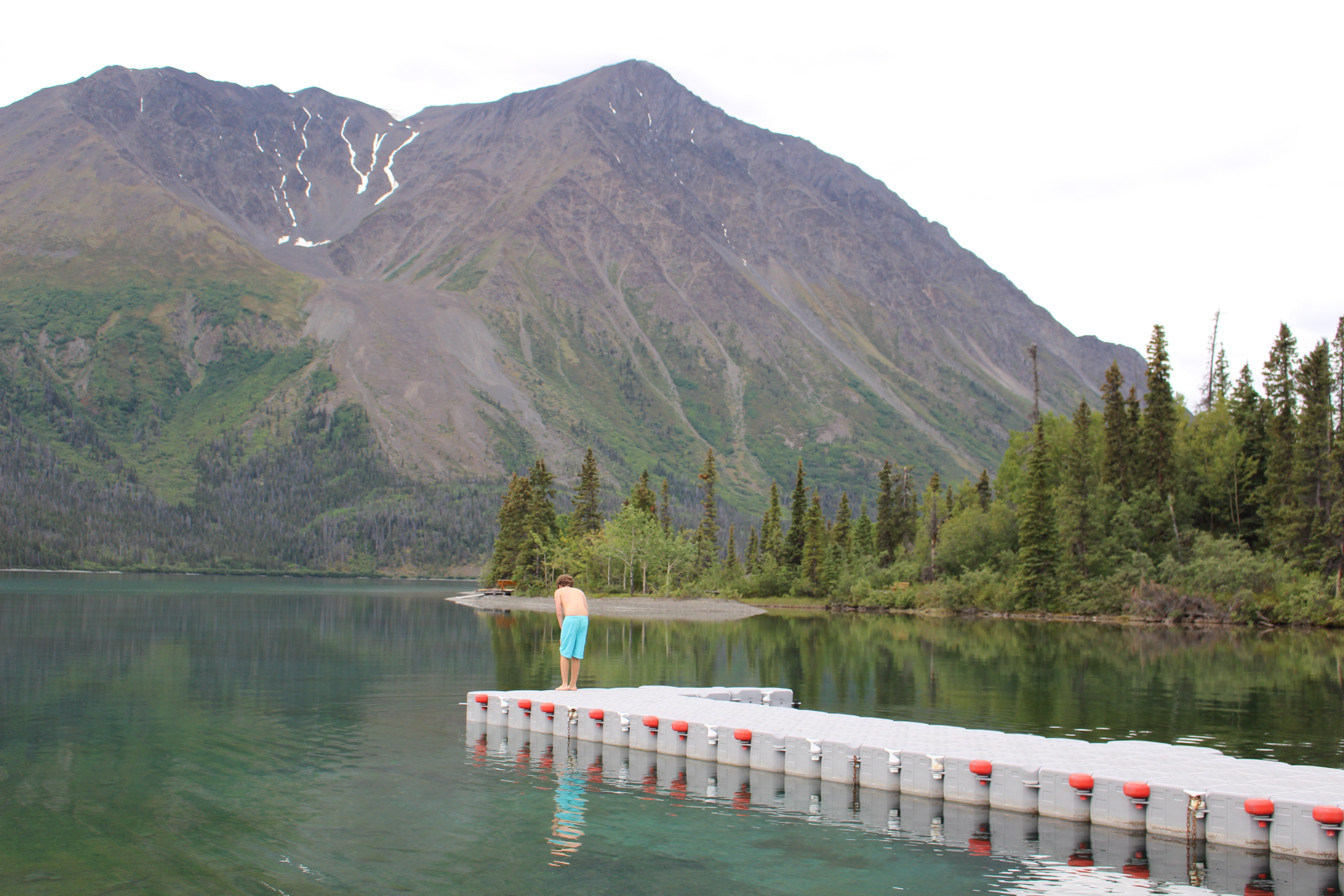
When I arrived in San Francisco, heavy rain was falling –a totally unanticipated event in this drought-ridden state. On-and-off heavy downpours continued as we drove to Echo Lake, where we planned to take the water taxi to its upper end.  On our drive, we debated options: stay in a cabin or lodge for the night? Head out in the rain?

At the Echo Lake store, we learned that the cabins across the way were not yet open, but a water taxi was loading up.  We rapidly re-organized our stuff, pulled on rain gear, and jumped in boat.

When we set off from the trailhead at the upper end of Echo Lake, my pack didn’t feel terrible. By then, the rain had stopped, and the leftover dampness tamped down the dusty trail that I remember from previous hikes here. The air felt fresh and the usually dusty sage brush smelled sagey. Orange paintbrush and pink phlox bloomed beside the trail. As we walked among the ponderosa at Haypress Meadows, the grass glowed vibrant green.

We hiked in about three miles from Upper Echo Lake to arrive at Lake of the Woods just as the gray sky was starting to clear.

We hiked in about three miles from Upper Echo Lake to Lake of the Woods just as the gray sky was clearing.  There, we found the perfect campsite, tucked in the trees 100 feet back from the lake (per the permit requirements), but just steps away from a granite peninsula that made for a fine lakeside kitchen and lounging platform. Mid-week in June we were the only campers here for two nights, although we encountered many heading up the trail from Echo Lake on Friday.

I was glad I remembered to bring a couple of dimes so that we could open the Bearikade bear-proof food canister, especially after I realized I had locked the swiss army knife in with the food. The meal was a delicious dehydrated Thai curry from Good-to-Go, a little start-up food company at the end of my street in Kittery.  Real vegetables — green beans, hunks of cauliflower — sprung to after soaking in boiling hot water for 20 minutes. As we ate dinner, a mother duckling and her five ducklings paddled by.

I left Kittery at 3:30 a.m. by sunset was enjoying a late sunset dinner at Lake of the Woods.  I'm glad I remember to bring a couple of dimes so that we could open the Bearikade food canister, especially after we realized we had locked the swiss army knife in with the food.

I left Kittery, Maine at 3:30 a.m. and by sunset was enjoying a late Pacific Time dinner at Lake of the Woods.

A bottle of champagne only weights a couple of pounds.

A bottle of champagne only weighs about 1.5 pounds, so we threw it into the pack. Happy Birthday, Natasha!

As the sun set, my friend and I toasted with the champagne we’d brought (along with our books) and continued our non-stop conversation about our families, jobs, mutual friends, politics, books, Morocco (where we both served as Peace Corps Volunteers), and a hundred other topics.

I was definitely enjoying the moment, but confessed that I wasn’t fully immersed in it, because in my head, I already was planning another backpack.  “I know what you mean,” Natasha said. “I’m feeling greedy for more of this.”

Our first view of Lake Aloha, which stretches out for 3.5 miles in the Desolation Wilderness.  The  lake is actually a low-tech reservoir formed by a series of five small dams constructed over the years to assure a consistent pool of water in the summer months.  But these are small stone and earth dams.

Our first view of Lake Aloha, which stretches out for 3.5 miles in the Desolation Wilderness. The lake is actually a group of small lakes and puddles stitched together by five dams into a shallow reservoir. As visible in this photo, the water was quite low for this time of year when it is typically filled with Sierra snowpack runoff.  The Lake is a popular destination for backpackers, but also makes a fine destination for a day hike, about 10 miles RT from upper Echo Lake .

That first night, more rain fell, but we were warm and dry in my tent. The next morning, after our backcountry coffee , we set out on the trail for Lake Aloha.

The 64,000-acre Desolation Wilderness, one of the nation’s most popular, is well-travelled. Gold miners once prospected here, without much luck, and cattle grazed in Haypress Meadows, before receiving official wilderness status in 1969 (although the area had been less restrictively protected for many years as part of the El Dorado National Forest).

In general, the Forest Service struggles with the idea of wilderness. Can an area threaded with hiking trails truly be called a wilderness?  Purists want to abolish trails and all man-made structures (like dams or shelters) in federal wilderness areas. However, a wilderness with no trails or trail signs and which is travelled by thousands of hikers is one in which many people will get lost.  Thus, all major trail junctions have signposts with arrows, but the trails are not marked with blazes or cairns.

Without blazes and cairns, it is fairly easy to lose the trail in the Desolation, but not hard to navigate back to where you thought you were, as long as you have a good map. We learned this truth early, when we missed the junction for Lake Aloha, and found ourselves confronting a large granite wall at the far end of Lake of the Woods. A couple of rocky slides looked like they might be climbable without the risk of death, but, having children back at home, we opted not to scramble up steep rock cliffs.  A short backtrack, along with our map, led us to the trail that threads up and through a meadow before descending to Lake Aloha.

Lake Aloha features many granite outcroppings and small granite islands  -- lots of nooks and crannies.  We found a private spot and jumped in, briefly, to the icy cold but refreshing water. Swimmers flock here in the summer, when the lake is shallower and warmer.

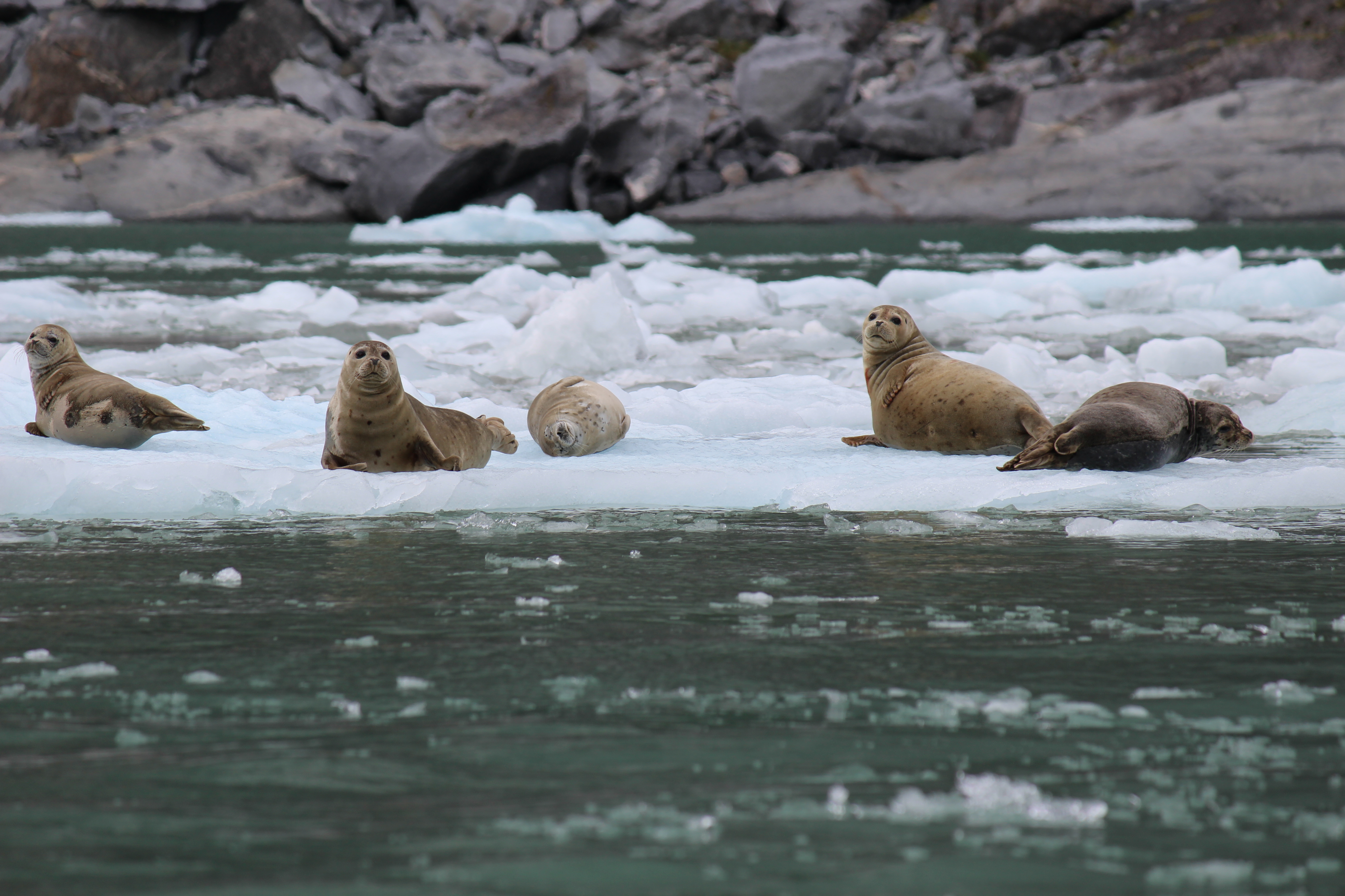
Lake Aloha features many granite outcroppings and small granite islands — lots of nooks and crannies. We found a private spot and waded in to the icy water for about 2 minutes. Swimmers flock here in the summer, when the lake is shallower and warmer.

In sharp contrast to its landscape, Lake Aloha conjures up hibiscus and jasmine and other lush tropical flowers. By mid-summer, the straggly stands of paintbrush and other wildflowers will have wilted, and this will be a landscape of granite, dust and scraggly Sierra pines.  But in early June, the walking along and above the lake was easy.  We set aim for Heather Lake, just beyond, and had lunch there before turning back to our base camp.

Again, we lost the trail. Instead of climbing to the meadow, we found ourselves looking out at the granite landscape of the Desolation Valley, with Pyramid Peak in the distance. We knew that Lake of the Woods was below this ridge and not far, but didn’t want to take our chances on bushwhacking to the head of a steep rock wall.  A short backtrack led us to the trail junction and we were on our way.

Another view of Lake Aloha as we turned back towards Lake of the Woods.

Another view of Lake Aloha as we turned back towards Lake of the Woods.

A very assertive Sierra marmot tried to steal our lunch at Heather Lake, just past the far end of Lake Aloha.

A very assertive Sierra marmot tried to steal our lunch at Heather Lake, just past the far end of Lake Aloha.

Back at the campsite, we finished off the champagne and stuffed ourselves with a chipotle three-bean chili before retiring to the tent.

Towards dawn, I woke up to the chorus of coyotes howling and yipping up on the ridge. Tucked in my sleeping bag, inside the thin walls of a nylon tent, I was exactly where I wanted to be. Although I had carried in more gear than I needed, I felt lighter than I had in years.

While exploring the Desolation Valley, we found this horse sculpture with a view of Pyramid Peak.

Before packing out, we explored the territory behind Lake of the Woods and found this sculpture looking to Pyramid Peak

Frata Lake, a sweet spot tucked behind Lake of the Woods in the aptly-named Desolation Valley. A helicopter buzzed above us in a zig-zag pattern and we wondered for whom or what  it was searching. As we explored, we realized that the Desolation Valley gradually flows down to the far end of Lake of the Woods. Maps are great!

Frata Lake, a sweet spot tucked behind Lake of the Woods in the aptly-named Desolation Valley. A helicopter buzzed above us in a zig-zag pattern and we wondered for whom or what it was searching. As we explored, we realized that the Desolation Valley gradually flows down from Lake Aloha to the far end of Lake of the Woods. Maps are great!

Sources and resources

The Desolation Wilderness is laced with over 150 miles of trails, and offers many great options for both day hikes and backpacks.  On an earlier trip, we enjoyed a dusty and hot family hike to Tamarack Lake (from Upper Echo Lake).  Swimming at Susie Lake is a great reward after a three mile-ish hike in.

Visit the Desolation Wilderness website for information on trails  and permits.

Although the 19th century writing reads slow, anyone who hikes in the Sierra needs to spend a summer slowly savoring John Muir’s My First Summer in the Sierra.

Intersecting slopes on Mount Chocorua, New Hampshire

IMG_0823

Climbing the ledges to the summit of Chocorua in Albany, N.H.

As we hauled ourselves up the granite cone of New Hampshire’s 3,478-foot Mount Chocorua, a middle-aged woman picking her way down the granite ledges groaned as she stretched out her legs to ease herself down an especially large slab.

My son paused to let her pass.

“I bet this hike is a piece of cake for you, isn’t it?” she asked him.

“Yup,” he said, as he pulled himself up the rock.

I wasn’t sure that I had heard correctly. “Did my son just tell you this hike was a piece of cake?” I asked the woman as she passed me.

“Well, I asked him,” she said,  “and he agreed.”

Was this the same kid who had to be enticed up mountains with M & Ms, Pringles, and chocolate chip cookies?

In planning the climb up Chocorua,the most southerly of the “big mountains” in the White Mountains, I’d wondered if the hike would be one of those mental drag events for all concerned (“Come on, just enough another half-mile to the summit, eat some cookies, you can do it!”)  I knew that physically, The Seal was more than capable of completing a 7.5 mile hike. But today’s hike would be the longest he’d ever attempted.

We ate our Pringles and sandwiches at the Jim Liberty Cabin.  I knew the cabin was on the side of the mountain, but imagined something a bit more ramshackle. The cabin was cleaner and cozier than I'd envisioned and I'm making plans to return for an overnight (first-come, first-serve).

We ate our Pringles and sandwiches at the Jim Liberty Cabin. I’d read that about the cabin and had imagined something a bit more dilapidated. The cabin was clean and cozy with sleeping space for about 8 people.  I’m making plans to return for an overnight (first-come, first-serve). Pringles, by the way, are my chip of choice on the trail because of the crush-proof can.

On this hike, everyone enjoyed the junk food—but as a treat and not a psychological necessity.  On the slope of Mount Chocorua, I  learned that that our personal slopes have intersected. My son’s has been steadily rising by micro-degrees.  Mine (and that of my husband) is slowly declining. We’re not plunging towards zero, but our lines aren’t moving upward.

The kid is beating the pants off of us.

He’s been hiking for years – sometimes with more enthusiasm than others, but the enthusiasm usually petered out after a few miles. So up until this perfect Columbus Day Sunday, I’d always selected hikes of  four, five or six miles tops.  Adding in a small pack of kids, if possible, helped to push the hiking drive.

View of the Sandwich Range from the ledges of the Liberty Trail.

View of the Sandwich Range from the ledges of the Liberty Trail.

I knew this day was coming. This summer, The Seal surpassed me in height.  This fall, he beat me in a 5K.  Next year, he’ll beat my husband.

From a ledge near the summit, looking out over Lake Chocorua and several others.

From a ledge near the summit, looking out over Lake Chocorua and several others.

The worst part of hiking, aside from the climb up, is the day after. I love hiking, but it kills me. I wake up stiff and creaky, wishing that a hot tub would magically appear in my backyard.

On the day after the Chocorua hike, the Seal bounced out of bed at 6 a.m. without a whimper. I asked him how he was feeling.

“Fine,” he said as he headed down the hall for a Minecraft session on the computer.

I crept to the kitchen to make coffee, feeling decrepit but thrilled about the intersecting slopes (besides, mine isn’t going downhill all that much). During years of Lyme Disease, it was frightening to watch my child head downhill with no explanation or diagnosis. Also, I’m happy to see The Seal, who never was interested in kicking soccer balls or shooting baskets, build confidence by climbing mountains.

Next year, Mount Katahdin. And after that, a hot tub?

Resources

We hiked a loop, up the Liberty Trail and down the Brook Trail (about 7.5 miles RT).  The Liberty Trail, a one-time carriage road, has fairly easy footing (by White Mountains standards) until you arrive at the ledges, while the Brook Trail has rougher footing and more rocks. This U.S. Forest Service  document provides basic trail descriptions and driving directions to each trailhead.

I’ve also hiked the Piper Trail, directly off Route 16, and probably the most popular route to the summit.  This is a busy mountain on fall weekends, so don’t expect solitude.

A good map is a must when hiking on Chocorua, due to the variety of trails and their many intersections.

Up in the air at Kluane National Park, Yukon Territory

The plane was waiting at Haines Junction airport.

At the Haines Junction Airport, our 1980 Cessna. Planes sure do have a long lifespan.  I’m glad I didn’t know that we were flightseeing in a plane that pre-dates the personal computer. If only well-maintained computers lasted this long.

The clearing weather presented both a threat (mostly to our wallets) and an opportunity.  As we pulled into Haines Junction, we debated our options.

The circle was nearly complete.  Along with my 13-year-old son, my Alaskan friend Elizabeth and I had traveled from Juneau to Skagway, and over White Pass to Carcross and Whitehorse. Canoed on the Yukon River and soaked in the Takhini hot springs.

Should we venture out to the Kluane-St. Elias Ice Fields — the world’s largest non-polar icefields and the largest protected natural area in the world? The plane was small, the price steep. Plus, after packing so much in already, might we fail to appreciate the awesomeness of the ice fields?

I reminded myself — and explained to my son — that as a living-on-the-edge 20-something, I had emptied my bank account to take a similarly expensive flight to Glacier Bay National Park. Although it’s  possible that I’ll get to Haines Junction again, I had to admit that it’s not likely. Hence, we went for it.

We began our flight over brown green alpine slopes where we could see specks of Dall sheep grazing, but soon began to fly up these glacier rivers into the heart of the Kluane ice fields.

We began our flight over brown green alpine slopes where we could see specks of Dall sheep grazing, but soon began to fly up these glacier rivers into the heart of the St. Elias-Kluane Ice Fields. Below, rivers of ice, trimmed with layer of gray silt.

As the plane buzzed its way deeper into the remote ice fields, the pilot pointed out different peaks, including Mount Kennedy, named for JFK after his assassination, and climbed in 1965 by his brother Robert — the only mountain Robert ever climbed.

robert kennedy photoThe expedition was the first attempt to climb Mount Kennedy. The highly experienced team included Jim Whittaker and Barry Prather, both part of the first American team to climb Mount Everest. Senator Robert Kennedy had been invited to join them, although he had a fear of heights and had never climbed any mountains (not even Mount Washington).  He accepted the invitation, he said, “for personal reasons that seemed compelling” and he “returned with a feeling — apart from exhaustion — of exhilaration and extreme gratification.”  Despite attempts to keep his participation a secret, word leaked out. The climb became a huge media event (for more, see newscast clip and other resources at the bottom of the post).

Robert Kennedy left several JFK mementos on Mount Kennedy, including his watch, a copy of JFK’s first inaugural address, and several PT boat tie clips.

This is either Mount X or Mount Kennedy, named for JFK.  Bobby Kennedy climbed Mount Kennedy (which is a major alpine expedition, not a hike) and left his brother's watch and some other artifacts on Mount Kennedy.

I took this photo near Mount Logan.  I believe it is Mount Kennedy (which is a subpeak of Mount Logan), but am not positive. What I am sure of:  if you find yourself in Haines Junction on a clear day, the flightseeing tour is a not-to-be missed experience.

In his Life magazine article, Kennedy wrote about how impressed he was by the climbers’ measured courage.  The climbers told him that “politics was far more dangerous than climbing.”

A view of Mount Logan, Canada's highest at X feet.  In the distance (but not in this photo), we could also see Mount Elias, the second tallest mountain in the US.

A view of Mount Logan, Canada’s highest at 19,551 feet, which puts it second in line behind Denali in North America.  On the tour, we also glimpsed Mount St. Elias (in Alaska), Glacier Bay, and the Pacific Ocean.

Today, scientists study the ice fields to learn more about climate change. This past summer (2014), bad weather stranded a group of Japanese scientists for two weeks after their pick-up date, at the camp pictured below:

In the heart of the ice fields, Japanese scientists who had been conducting research were stuck on the ice fields two weeks after their departure date due to bad weather. The scientists had just been flown out that morning.

A view of the research camp.  The stranded scientists were picked up earlier on the day of our flightseeing tour. Note the plane tracks on the ice fields.

A "close up" view of the research station. Note that one person is still down there, and hopefully still sane after spending two weeks of waiting out the rain, fog and snow.

A “close up” view of camp. Note that one person was still down there, and hopefully still sane after spending two weeks of waiting out the rain, fog and snow, in very close quarters.

A moulin in the ice field.

A moulin in the ice field. A moulin is a vertical shaft through which water melts and flows to the bottom of the glacier, where it serves as a puddle-like lubricant that facilitates glacial motion. You don’t want to fall into one of these things.

Beautiful puddles.

Beautiful puddles.  Bitterly cold, but they bottom out on the surface of the glacier, unlike the bottomless moulins.

Heading back to Haines Junction, using the glacier as a path.

Heading back to Haines Junction, and following the glacier as a highway.

The plane landed at the Haines Junction airfield like a feather dropping to the ground.  Behind the pilot, one passenger was suffering from the effects of motion sickness (it was messy).   Even so, he was grinning along with the rest of us.  Definitely not too much awesomeness.  How could we go to Kluane National Park and not take a dip in the lake?

After our flight, we camped at Kathleen Lake Campground, a $10 bargain that mentally reduced the cost of the flightseeing tour.  The next morning, we took a dip in the lake, where average summer surface water temperature hovers around 52 degree F (11 C), just a few degrees less than what we are used to, but cold enough to render The Seal speechless.

Heading down the Haines Highway to pick up the ferry in Haines, Alaska, we passed by Dezadeash Lake. Although just a few miles south of Kathleen Lake, Dezadeash is a shallow bath tub known for its warmer temperatures (up to 65 degree F/18 C in summer) and many migratory birds, including Trumpeter swans.

Trumpeter swans on Dezadeash Lake.

Trumpeter swans on Dezadeash Lake.

Links and resources

Kluane Glacier Air Tours operates out of the Haines Junction Airport.

“The Strange History of Mount Kennedy,” by Sean Sullivan at The Clymb.

Our Climb Up Mount Kennedy,” by Robert Kennedy.  Reproductions of images and text from Robert Kennedy’s April 9, 1965 Life magazine account of his climb.

Below, news report Senator Robert Kennedy’s climb up Mount Kennedy.

A slew of seals at LeConte Glacier

The blue icebergs bobbed and floated seductively, dangerous but enticing, clues that somewhere upstream lay a glacier.  But in Southeast Alaska, navigating a field of icebergs field is dangerous is any season, all the more so in November, with its short days and chilly temperatures.

Icebergs still cluster around the mouth of LeConte Bay as they did in 1879 when John Muir visited this region. When we visited, This one was especially striking.

Icebergs still cluster around the mouth of LeConte Bay as they did in 1879 when John Muir visited this region. Then, the glacier reached almost to the head of the bay.

But back in 1879, naturalist John Muir, being Muir, would not be dissuaded.  This was a man completing a canoe voyage of several hundred miles, in November, in Alaska. After several weeks of exploring southeast Alaska, Muir was  heading back to Fort Wrangell with Captain Toyatte, his Stickeen Indian guide, and several others.   As their party passed between a headland and the opening of Wrangell Narrows, the river of icebergs and floes floating out of the mountains intrigued Muir.  He wanted to follow the trail, to see the legendary Thunder Glacier for himself.

Captain Toyatte, knowing the hazards well, issued a strong protest. The icebergs might upset the canoe, tossing them and all their gear into the water. At worst, they would drown in the icy water; at best, they might make their way to a wilderness shore with no gear, food, matches, or way of transport.

But Muir, being Muir, kept pushing. “Oh, never fear, Toyatte,” he said. “You know we are always lucky–the weather is good. I only want to see the Thunder Glacier for a few minutes, and should the bergs be packed dangerously close, I promise to turn back and wait until next summer.”

Reluctantly, Toyatte paddled into icebergs.  The glacier, Muir said, was “one of the most imposing of the first-class glaciers I had as yet seen…..a fine triumphant close for our season’s ice work.”  

Because of the dense pack of bergs, Muir observed the glacier at a distance of two miles. We were lucky, and were able to come with a half-mile (or maybe even a bit closer)

Approaching LeConte Glacier.  We stayed a good distance from the glacier, as room-sized chunks of ice calving from the face create waves that can easily swamp a small boat.

Approaching LeConte Glacier. We stayed a good distance from the glacier, as room-sized chunks of ice calving from the face create waves that can easily swamp a small boat. LeConte is also known for “shooters,” icebergs that break off the face underwater and then shoot upwards.

As for John Muir, visiting LeConte Glacier, for us, was both an afterthought and a triumphant close to our stay in Wrangell, Alaska.  The bears at AnAn Bear Observatory had drawn us here, and we also planned to cruise up the Stikine River. Why not visit the  glacier while we were there?

Like Toyatte, I felt some trepidation, revolving around my credit card bill.  But when I would get to Wrangell again? We signed on.

I am so glad that we did.  LeConte Glacier, named in 1887  for Muir’s close friend, Joseph LeConte, a geologist at the University of California in Berkeley, was every bit as imposing as Muir described it. (The glacier was named by Navy Commander Charles. M. Thomas who conducted the first official surveys several years after Muir’s visit).

Although the glacier is a regular destination for small boats from Petersburg and Wrangell, LeConte is tucked away in a lesser-visited region of Southeast Alaska.  Thus, visitors can enjoy its splendors in relative solitude — we saw only one other boat (briefly) on the day we visited — and its huge population of seals, more than 2,000 of which live in the fjord.

The seals of LeConte Bay. More than 2,000 make the bay (which is more of fjord) their home.

The seals of LeConte Bay. More than 2,000 make the bay (which is more of fjord) their home.

For the non-glaciologist, glaciers are almost impossible to comprehend: LeConte stretches back 21 miles into the mountains and in places is a mile deep.   Although LeConte, the most southern tidewater glacier in southeast Alaska, has retreated 2.5 miles since 1887, it has both receded and moved forward in the past 30 years, and scientists regard it as stable (that is, it may recede one year but will move forward in another).

The tidewater is why the Tlingit Indians gave it the name, Hutli, which Muir translates as “Big Thunder.”  According to Muir, the derived from a mythical bird that produced sounds of thunder when it flapped its wings.  And LeConte Glacier makes big thunder, sometimes many times a day, when house-sized chunks of ice calve from its face and drop into the fjord, as in this video:

The glacier was magnificent, awe-inspiring and beautiful.  The seals were a very thick layer of icing on an already rich cake.  Amidst all the seals, my Seal was in heaven.

Our daylong trip to LeConte also included a stop in the fishing village of Petersburg. I’d been here once before on a dark 2 a.m. ferry stop, so I enjoyed strolling around in daylight.

Petersburg, Alaska, was established by Norwegian immigrants.  Many touches of Norway are evident. We stopped here for a couple of hours but easily could have enjoyed more time here.

Petersburg, Alaska, which had been the site of Tlingit summer fishing camp for centuries, was settled by Norwegian immigrants in the late 19th century. Many touches of Norway are evident. We stopped here for a couple of hours but easily could have enjoyed more time here.

Reading John Muir is not for the faint of heart, as his 19th century prose is dense and wandering.  Even so, I’ll dare to conclude with his 1879 conclusion on Alaska:

To the lover of pure wildness Alaska is one of the most wonderful countries in the world. No excursion that I know of may be made into any other American wilderness where so marvelous an abundance of noble, newborn scenery is so charmingly brought to view as on the trip through the Alexander Archipelago to Fort Wrangell and Sitka. Gazing from the deck of the steamer, one is borne smoothly over calm blue waters, through the midst of countless forest-clad islands… nearly all the whole long way is on inland waters that are about as waveless as rivers and lakes. So numerous are the islands that they seem to have been sown broadcast; long tapering vistas between the largest of them open in every direction.

Although I probably could use fewer words, I couldn’t have said it better myself.

(John Muir’s book, Travels in Alaska, is available in multiple formats at Gutenburg.org, and also readily available in print).

Wrangell and Petersburg Resources

Visitor info for Petersburg can be found at the Chamber of Commerce.

For more details on LeConte Glacier, see Pat Roppel’s 2013 article, Southeast history: LeConte Glacier, in Capital City Weekly (a Juneau newspaper).

From Wrangell, we visited LeConte Glacier in a jet boat with Brenda  Schwartz Yeager of Alaska Charters and Adventures.  There are several similar outfitters in Wrangell and Petersburg.

In Wrangell, the lumber industry ruled for many years, but today, fishing and tourism keep the town going.  Large cruise ships can’t visit Wrangell (a plus, in my opinion) although several smaller adventure-type cruises visited where we were in town.

We stayed in a roomy suite at the Wandering Channel Bed & Breakfast.  The Stikine Inn is a full-service hotel, with a good restaurant.  The Wrangell town website lists all lodging establishments.  You don’t need a car in Wrangell unless you want to explore more of the roads and trails of the Wrangell Island.  A daily Alaska Airlines flight provides service from Seattle or Juneau.


Inventing Nature at Acadia National Park

I love the barren open summits of Acadia National Park on Mount Desert Island, Maine.  On Memorial Day, we set out from the Jordan Pond House and completed the 6-mile-ish out-and-back hike to Penobscot and Sargent Mountains.

We started hiking beneath gray skies, just after a shower, but by the time we climbed out of the trees onto the ridge of Penobscot Mountain, the clouds were clearing and the view expanding with each upward step. When we reached the 1,373-foot summit of Sargent Mountain, we breathed in 360-views of a vast panorama:  Frenchman’s Bay, the Cranberry Islands, Cadillac Mountain, Eagle Lake, Somes Sound.  Black files buzzed around our heads, but couldn’t detract from the awesome experience of these natural vistas. (Below, the view of Jordan Pond on our ascent down Penobscot).

Samuel de Champlain made this map of the northeastern coast of American on his 1604 voyage.

Mount Desert Island, in this cropped version of Samuel de Champlain’s 1604 map of the northeastern coast of America. (See link at bottom of post to access view of entire map).

However, when explorer Samuel de Champlain “discovered” Mount Desert Island in 1604, he both saw and didn’t see what we see today.

The mountains he described still dominate the view from the bay, but de Champlain was exploring a dark wilderness, full of hidden rock ledges, unknown beasts, and potentially dangerous people.  His ship ran aground on a rock that ripped a hole in the keel.  Where we see beautiful open summits, de Champlain saw lots of rock, a barren inhospitable desert.

In his description of the island, he wrote, “It is very high, and notched in places, so that there is the appearance to one at sea, as of seven or eight mountains extending along near each other. The summit of the most of them is destitute of trees, as there are only rocks on them. The woods consist of pines, firs, and birches only. I named it Isle des Monts Déserts.”

For the first 18th century European settlers, Mount Desert Island was a desert, an isolated place where hardy families eked out a living from fishing and small farms.  But at some point, perspectives changed.  The rocky desert became an Arcadia, a version of the ancient Greek district whose name contains layers of meaning, including “idyllic place” and “refuge.”

Mount Desert Island did not change.  But our ideas about nature did, largely due to the work of artists who transformed the island from a rocky outpost to a place of inspiration and wonder in which mind, body, and soul could be rejuvenated.

The first to arrive was artist Thomas Cole, the founder of the Hudson River School of landscape painting, who came to Mount Desert Island in 1844, and created several paintings that were widely exhibited in the years to follow.  Cole’s pupil Frederic Church followed in his footsteps, making his first trip to the island in 1850, where he sketched and made notes for future paintings.  Other artists followed.

Thomas Cole's "View Across Frenchman's Bay after a Squall" (1845).  Cincinnati Art Museum.

Thomas Cole’s “View Across Frenchman’s Bay after a Squall” (1845). Cincinnati Art Museum.

Collectively, at Mount Desert and in other places in the northeastern United States, the Hudson River School of artists invented a new and more romantic concept of nature as a place of beauty, a source of mental sustenance and renewal in the industrial age.

The skies might darken with clouds or twilight, but no longer was the dark a source of uncertainty and fear  Instead, the interplay of darkness and light offered another way to view the world’s grandeur.  Dangerous surf and forbidding rocks became a source of “the sublime” — that combination of beauty and terror generated by the sight, sound, and feel of a massive wall of water crashing against a cliff.

"Sunset, Bar Harbor," by Frederic Church (1854)

“Sunset, Bar Harbor,” by Frederic Church (1854). Possibly influenced by writer Henry Thoreau’s essays about travels in the Maine woods, Church returned to Maine to visit the North Woods. He eventually bought property in the Millinocket area, where he painted Mount Katahdin and other landscapes. But that’s a blog post for another day.

Although marketing was not their intention, in reinventing “Nature,” the Hudson River painters who visited Mount Desert created a place that many wanted to visit. In the mid-19th century, newly middle-class “rusticators” began to come to the island. They boarded in locals’ homes, took long walks and hikes, and breathed in the smell of the Atlantic.

Then, during the Gilded Age, the super-wealthy discovered the island, built massive summer homes, and transformed the rocky desert to a high society destination.  Eventually, some of those people, led by George Dorr and John D. Rockefeller, Jr., donated large chunks of land so that this natural wonderland could be enjoyed by all Americans and not just a wealthy few.  The Park was established in 1919, thanks in large part to Dorr, Rockefeller, and others. But the idea of nature as being worthy of preservation was the creation of 19th century artistic visionaries–the painters, but also writers like Henry Thoreau and John Muir, and photographers like Yellowstone’s William Henry Jackson—who transformed the way we think about nature.

Noted maritime artist Fitz Henry Lane, of Gloucester, Massachusetts, travelled to Mount Desert and to paint this scene, titled "Off Mount Desert," in 1856.  (Brooklyn Museum).

Noted maritime artist Fitz Henry Lane, of Gloucester, Massachusetts, travelled to Mount Desert and to paint this scene, titled “Off Mount Desert,” in 1856. (Brooklyn Museum).

Today students who study the arts (in all of its forms) often have to endure questions about the value of what they are doing.  How they will support themselves?  When will they stop dreaming and get a real job?  After all, the arts are “decoration,” nice if you have the time to dabble, but not essential.

These questions about the value of art are not a new phenomenon.  And of course, it is difficult to make a living an artist.  But artists and writers, as much or more so than scientists and engineers, are inventing the future as they shape and create ideas.

What ideas are artists, writers, and musicians transforming today?

Note: Take a peek below for examples of how artists continue to follow in the footsteps of Cole, Church, Lane and others today. For more information on another great hike in Acadia, see my paragraph about Mount Dorr via the Homans Path in Five Great Family Hikes in Maine.

Mount Desert III, 1996, by Richard Estes.  The Portland Museum of Art is exhibiting a major retrospective collection of Estes' work this summer (2014).

Mount Desert III, 1996, by photorealist painter Richard Estes. The Portland Museum of Art, in partnership with the Smithsonian Museum of American Art, is exhibiting a major retrospective collection of Estes’ work this summer (2014).

For more on the Estes exhibit, see the Portland Museum of Art website.

Contemporary artist Philip Koch pays tribute to Thomas Cole and other 19th century landscape painters in his painting, "Frenchman's Bay." (See resources below for links to Koch's website).

Artist Philip Koch pays tribute to Thomas Cole and other 19th century landscape painters in his painting, “Frenchman’s Bay.”

To learn more about Philip Koch, see his blog.

Head of Somes Sound, by Ernest McMullen.

Head of Somes Sound, by Ernest McMullen.

For more on artist Ernest McMullen, see The Gallery at Somes Sound.

Additional sources and resources:

Entire de Champlain map of northeastern coast of America, from his 1604 voyage. Champlain quote from Memoir of Samuel de Champlain, Volume II, 1604-1610, Chapter 5.

For more on Frederic Turner’s paintings in Maine (including many in the Millinocket region), see John Wilmerding’s Maine Sublime: Frederic Edwin Church’s Landscapes of Mount Desert and Mount Katahdin. Ithaca, NY: Cornell University Press, 2012.

“Mount Desert Island and Isle au Haut (Modern Acadia National Park, ME)”.  National Park Service Archeology Programs.

Mount Desert Island: Shaped by Nature.  Maine Memory Network.


Art amidst the mills of North Adams

November December 2013 104

Fall leaves and outdoor swimming go great together!

A decaying mill town on a gray November weekend in an isolated corner of Massachusetts might seem an unlikely destination, but North Adams had been on my radar for a while.

The  Massachusetts Museum of Modern Art (Mass MoCA) offered intriguing, colorful and large-scale modern art likely to engage a 12-year-old non-artsy boy.  The Porches Inn provided a 24-hour outdoor heated pool and hot tub.  And Spruce Hill, just outside of town, is listed in Jeffrey Romano’s book, 100 Classic Hikes in New England.  Plus, right above town, we could experience the hair-pin turn on Route 2.  Why go to Disney World when North Adams awaits?

North Adams is a classic New England mill town, with acres and acres of massive red-brick empty mill buildings. Manufacturing in North Adams dates back to the Revolution, but now industry is all but dead, the final nail in the coffin coming with the 1985 closure of the Sprague Electric Company plant on Marshall Street (previously the home of the country’s largest textile print mill).  The Sprague plant was much more than a small-town components factory; it had state-of-the-art equipment and served as the company’s research and development center.  Employees included physicists and electrical engineers as well as line workers making electrical components.  At its peak in the 1960s, the company employed more than 4,000 workers.  The 1985 closure struck a massive blow to the community.

In the 19th century, sheep farmers in the hills around North Adams abandoned their fields for the relative comforts offered by row houses in the town.

In the 19th century, sheep farmers in the hills around North Adams abandoned their farms for jobs in the mills and the comforts offered by the row houses in town (on the Spruce Hill hike).

Soon after plant’s closure, town officials set their sights on reviving the town. In 1999, Mass MoCA opened at the sprawling Sprague complex to become the world’s largest contemporary art museum.  Although it’s unlikely that art will ever replace Sprague’s 4,000 jobs (plus the related jobs in other businesses), Mass MOCA has served as the cornerstone of the town’s revival, with other art galleries opening in its wake, along with restaurants, shops, and The Porches Inn.

Mass MoCA is fun – the perfect art outing for families with tweens or teens (and many were wandering around the place). Kids who might be bored with the portrait galleries of the Museum of Fine Arts will find much here to intrigue them.  The exhibits are constantly changing.

When we visited, Jason Middlebrook’s monumental hanging water fountain sculpture, Falling Water, packed a big “wow” factor. Mark Dion’s Octagon Room offered an intriguing bunker-like space to explore.  The colorful patterned paintings of Sol Lewitt (more or less on permanent exhibit) provide hope to non-artists that they too can create something beautiful, as Lewitt allows others to use his patterns to recreate his art.

The marble bridge, unique in North America, offers another sort of sculpture at Natural Bridge State Park, just outside of town.

The marble bridge, unique in North America, offers another sort of sculpture at Natural Bridge State Park, just outside of town.

European sculptor Joseph Beuys’s three-dimensional montage, Lightening with Stag in Its Glare, intends, per the catalog, to evoke “the spiritual power of animals and nature” while celebrating “the victory of socialist warmth and self-determination over materialist greed and alienation.”  For kids, however, the most interesting question is whether the irregularly shaped brown objects lying on the floor are lacquered turds or primordial worms (or perhaps both).

November December 2013 051


Just getting up to see Michael Oatman’s Airstream trailer repurposed as some kind of exotic aircraft (titled “The Shining”) is a unique museum adventure.  Visitors have to climb a few flights of stairs past old boilers and pipes to reach the outdoor platform where the trailer is perched.  The rusted pipes and equipment, which probably clanked and boiled well into the 1980s, now seem ancient.

A chilly November dawn in North Adams.

A chilly November dawn in North Adams.

Across the street from MASS MoCA, the Porches Inn is laid back and easy-going, with 24/7 access to the hot tub, sauna and pool. Visitors can order happy hour drinks at the small bar and sip them in the living room.  We decided to catch the sunrise each morning from the hot tub, although we kept forgetting to get up early enough due to the recent “fall back” switch to Eastern Standard Time.  Although we missed the official moment of the sun rising, we enjoyed sitting in the hot tub sipping fresh coffee and watching the pink sky.

The 3.5-mile loop hike up to Spruce Hill provided a good opportunity for leg-stretching and views of North Adams and Mount Greylock.  The loop trail through the forest took us along a massive beaver swamp, with many freshly chewed trees. The beavers remained hidden.

View from the summit of Spruce Hill, with Mount Greylock in the background.

View from the summit of Spruce Hill, with Mount Greylock in the background. The ledge was slippery, with a steep drop-off on one side. I lost my footing and fell hard on my behind, but at least I was on the right of the ledge!

In Mass MoCA, I took plenty of photos of the art, but I can’t publish those shots online. So when I was in North Adams, I tried to make my own art by shooting artsy photos. If you don’t know what they are, then I guess I have succeeded in creating modern abstractions (see below).

By the way, last year, on this same November weekend, we made our first-ever trip to Orlando to visit Harry Potter world at Universal Studios.  Jeremy rated that trip as a five-star adventure.  Our weekend in North Adams:  4.5 stars.  A pretty good rating, I’d say, for a place that exemplifies “November” in New England (i.e. gray, barren, and chilly).  Chamber of Commerce, take note:  with the right spin, marketing North Adams as the alternative destination for families weary of roller coasters just might work.

What kind of monster beavers can fell a tree this thick?

What kind of monster beavers can fell a tree this thick?


Stream in fall.

Stream in fall.


Modern art in the forest: the exposed veins of a tree.

Modern art in the forest: the exposed veins of a tree.

The wind howls, and we stir the pot

As I write at the kitchen table, a pulled pork lunch for 17 simmers in the crockpot and the wind shrieks above the stove vents.  That wind has been howling for the past four days, hitting a peak gust of 121 mph on Sunday, when the temperature dropped to -25 and the wind chill was a crazy -76. And we summit volunteers are loving it!

Standing on the summit, with the Observatory Tower in the background.  On the first couple of days, we saw many winter hikers at the summit, before the advent of  the high winds that made hiking very unsafe.

Standing on the summit, with the Observatory Tower in the background. On the first couple of days, we saw many winter hikers at the summit, before the advent of the high winds that made hiking very unsafe.

The possibility of extreme weather is one of the main reasons why I signed on for the eight-day volunteer stint in January.  I knew that extreme weather meant we wouldn’t do any real hiking, but I was okay with that, as I’m rusty on my winter hiking skills. I had the warm layers I needed to safely push myself into 100 mph winds, plus a pair of sneakers for indoor laps around the rotunda to get some exercise in between short jaunts outdoors.


During my stay on the mountain, I’ve been reading about the winter of 1870-71, when State Geologist Charles Hitchcock and Assistant Geologist Joshua Huntington, along with three other men, and several visitors, spent the first winter on Mount Washington.

This scientific expedition set up shop in a small room carved out of the depot for the just-completed cog railway.  They spent the winter doing weather observations, using some of the same instruments that the observers use today.  They communicated to the outside world via daily telegraphs and were constantly heading out in extreme weather to repair the telegraph line.

Winter on Mount Washington

During their first full-on winter storm, some time in December, the group spent a frightening night huddled around the coal stove, as they listened to the roar of the wind and wondered if their quarters would hold fast.  The building, which was held down with chains, withstood the wind, and gave the group faith that they would weather future storms. Glass panes might shatter and they might have to stay up much of the night keeping the stoves going, but they could enjoy listening to howling winds rather than fearing them.

Hitchcock, Huntington and their companions each wrote different sections of Winter on Mount Washington, the 1871 book describing the expedition.  The prose is dense, written in the leisurely 19th century style that can be tedious for modern readers.  But what strikes me as I read about their days on the mountain is how little the winter experience has changed.  Although the men lacked today’s comforts, they were perfectly cozy in their small quarters. They got up early and piled on their gear to watch the sunrise.  They watched the clouds float up over Jefferson and Adams.  They marveled at the sunsets over the Franconia Ridge.

In Chapter 11, “Life on the Summit,” Joshua Huntington wrote,

Most persons suppose that life on Mount Washington in winter must be gloomy, and gloomy enough it would be, at times, when the summit is enveloped in dense clouds for weeks, if it were not for the cheering click of the telegraph instrument.  They might suppose also that time would be extended indefinitely; that at night we should wish it was morning, and that in the morning we should long for night to come, and thus drag out a wear existence.  If the time of any persons in excellent health is wholly occupied in a pursuit that is congenial they are rarely gloomy, and are almost unconscious of the flight of time. But here, besides good health and time occupied, there is an excitement found nowhere else.”

“One gorgeous sunrise throwing a flood of light across a sea of clouds, one glorious sunset tingeing the clouds with crimson and gold, and the sun descends leaving the blush of day upon these snowy summits, or a storm unprecedented at lower elevations, infuse into our life enough that is grand and sublime to occupy the thoughts for weeks. With such surroundings, a person, on account of the intense excitement, may live too fast to have life extended to full three score years and ten; but there is a pleasure in it that would fully compensate for a few days cut off from the number to which life might be lengthened if passed in some quiet retreat, undisturbed by anything hat arouses the whole being, and carries the mind into ecstasies of delight. So days and weeks pass, and we are almost unconscious of the lapse of time.”

I couldn’t have said it better myself.


The Stage Building at sunset. This building, which serves as a depot for the Cog Railway, is a replica of the 1932 Observatory where the record wind was recorded.   The current Observatory building opened in 1980.

The Stage Building at sunset. This building, which serves as a depot for the Cog Railway, is a replica of the 1932 Observatory where the record wind was recorded. The current Observatory building opened in 1980.

My post here is reprint from my January 28, 2014 post on the MWOB “Observer Comments” blog.  Below, more photos from winter on Mount Washington.