We set off for Poplar Hut on a perfect winter afternoon.
At Poplar Hut, nestled on a hill in Maine’s Carrabassett Valley, the staff sets out the champagne glasses at 9:30 p.m. By 10 p.m., most guests will be fast asleep in their bunks, worn out by an afternoon of snowshoeing, cross-country skiing or hiking into the hut.
But the party continues for those dedicated to the stroke of midnight. They sip on beer, wine or softer beverages, while pursuing wild games of Bananagrams and Settlers of Catan. Completing jigsaw puzzle becomes a communal activity, and then everyone settles into the comfy couches by the fireplace or in the upstairs reading room, waiting for the clock to strike midnight.
The countdown begins. At midnight, instead of watching the ball drop in Times Square, we cheer as a crew member ceremoniously lowers an old ball of a wasp nest tied to the ceiling.
This is my first overnight visit to Maine Huts & Trails, and I’m wondering what took me so long.

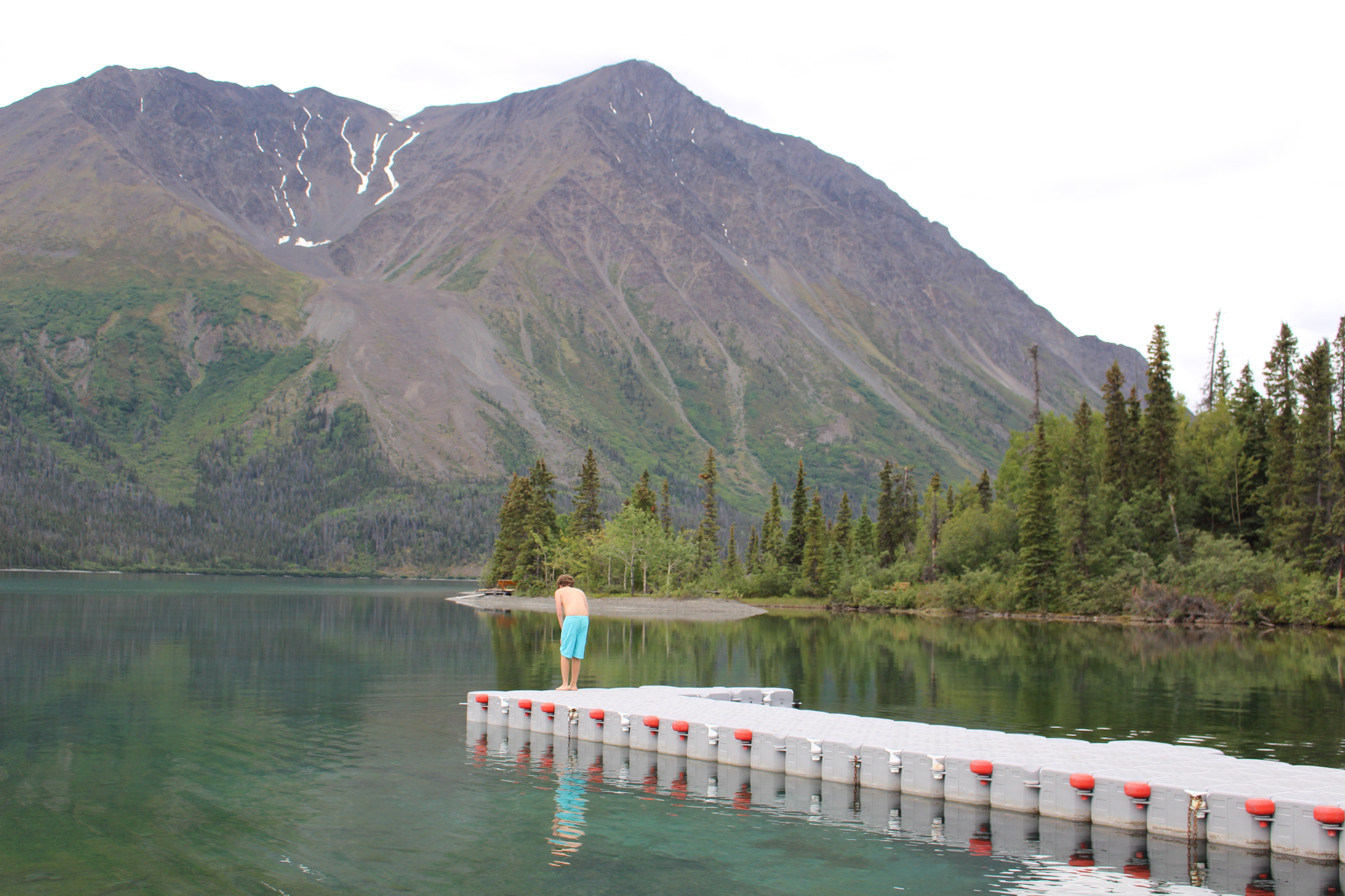
Two feet of fresh snow made for nice soft cross-country ski conditions, with no scary ice to contend with when skiing downhill. Shown here is the junction at the Narrow Gauge Trail (a popular rail trail, to the left) where it intersects with the Maine Hut Trail to Stratton Brook Hut. The trail climbs about 1,000 feet in 4.7 miles from the Airport Trailhead, making for a good workout. A shorter 3.1 trail with less elevation gain departs from the Stratton Brook/Route 27 trailhead.
Maine Huts & Trails operates four “huts” — really more like backcountry lodges — in western Maine which people can visit by foot, ski, bike, or snowshoe. Poplar Hut opened in 2008, followed by Flagstaff Hut on Flagstaff Lake (2009), Grand Falls Hut on the Dead River (2010), and, in 2012, Stratton Brook Hut, located on a knoll with views of the Bigelow Range and Sugarloaf Mountain. The non-profit organization eventually hopes to build a dozen huts stretching across Maine’s woods up to the Moosehead Lake area. Theoretically, skiers, hikers, and bikers can travel from hut to hut, which some do, while others visit for a night or two. In the winter, the huts also make a great lunch destination for a cross-country ski or snowshoeing day trip.
Previously, I had visited cozy Flagstaff Hut for lunch on a summer boat excursion with Jeff Hinman of Flagstaff Lake Scenic Boat Cruises. But I’d been under the mistaken impression that an overnight hut trip in winter was too much for kids to handle, and thus had put off a winter visit for several years.
When we finally set out on our cross-country skis, we traveled under near-perfect circumstances: two feet of snow had dropped on the Valley that week, making for soft if imperfectly groomed skiing trails (with post-dump grooming still in process). The temperature, by winter standards, was mild, around 30 degrees. The three-mile ski up to Poplar (gaining 500 feet of elevation) was definitely challenging, but we had all afternoon to get there, and the prospect of a bunk nap before dinner.
Dinner was a slow-cooked roast beef and assorted side dishes, along with a delicious roasted veggie-lentil loaf for vegan/vegetarians (Note: backcountry huts of all kinds always make amazing vegetarian meals; you can count on at least one crew member being a serious vegetarian cook). The chef had piled the champagne cupcakes with way too much frosting and I ate every bit of it (knowing I would need the energy for the next day).

New Year’s cheer at Stratton Brook Hut (I got so caught up in my puzzle-building at Poplar that I forgot to take pictures there). Behind the fire place are several cozy chairs and a couch.
At Poplar Hut, as I talked to folks gathered around the tables, I was struck by the variety of guests there: the creaky and the lithe, the young, old, and middle-aged, and both novice and experienced backcountry travelers. Because the huts offer many choices and routes, they make backcountry experiences accessible to all kinds of people. Yes, you do have to work a bit to get here, but most of the huts aren’t that far from roads, even though they feel remote. We skied into Poplar on the 3-mile Maine Hut Trail, but could have snowshoed the same route, or on a shorter, 1-mile(-ish) trail from another trailhead. Visitors do need to bring a sleeping bag, but you can have your gear shuttled from hut to hut, as we did on Day 2 and 3 of our visit.
On New Year’s Day, we enjoyed a breakfast of buckwheat pancakes, eggs, and bacon and good coffee before setting out for Stratton Brook Hut, about seven miles away. Because of the heavy snow, we ended backtracking on the Maine Trail Hut to the Narrow Gauge Trail, where we eventually headed up another Maine Hut Trail to Stratton Brook Hut. Other trails follow different routes, but would have been difficult to navigate in 24 inches of unbroken snow.
We arrived at Stratton Brook Hut around 2 p.m. I was ready to move in. Stratton Brook is built on a little piece of heaven situated between Sugarloaf Mountain and the Bigelow Range. Great views abound. (I definitely want to look into the volunteer caretaker program when I am retired).

View of the Bigelow Range from inside Stratton Brook Hut.
That night, the crew cooked up a feast of balsamic chicken, plus the requisite dessert: a berry cobbler that tasted summer fresh.

Sunrise at Stratton Brook Hut.
At Stratton Brook, we had our own little bunk room and slept well, rising in time to get out for views of the winter sunrise.
For breakfast, we enjoyed more pancakes and eggs and conversation with a group from New Brunswick, Canada. The night before, we had embarked on another puzzle project and could not leave without finishing. But we were in no hurry — the sled took our gear, we enjoyed our coffee and puzzle-building, and then geared up for the ski downhill to the Airport Trailhead.

One last view of the Bigelow Range before skiing down the trail. Like many, I am not a confident cross-country skier on descents, but found the 1000-foot gradual descent manageable with my ski-pole-between-the-legs braking technique. If conditions were icy, we probably would have chosen snowshoes.
So, now I’m a member of Maine Huts, and already making my plans for next year. Or maybe sooner!
Sources and resources
For a family, staying at Maine Huts & Trails is a splurge, as the per-person price adds up. However, I consider the huts a good value: the $130 weekend/holiday rate per night includes three meals, with a 50% discount for kids ($65, including teens). One day of ski tickets at nearby Sugarloaf Mountain, with no meals or lodging, would cost about the same for our family of three. I don’t mean to pit one experience against the other, just to show that the huts are reasonably priced for the experience they offer. Sunday-to-Thursday rates are about 30% less, and members get a 10% discount, plus a variety of other discounts, including some steep “flash-sale” discounts.